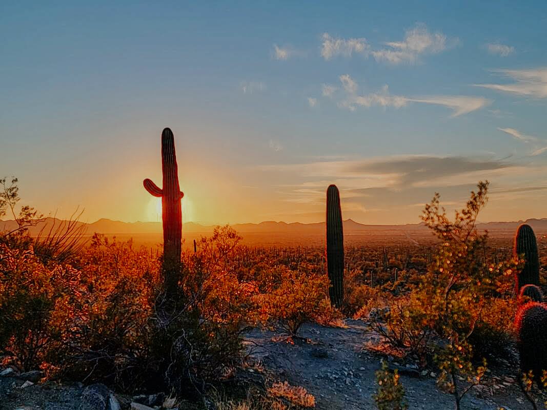
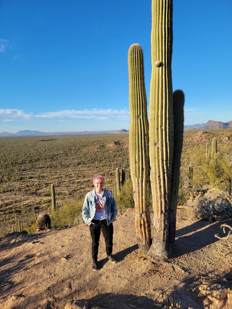
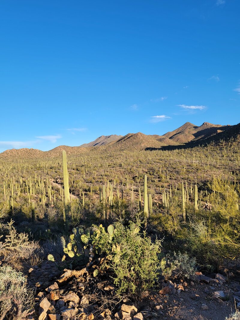
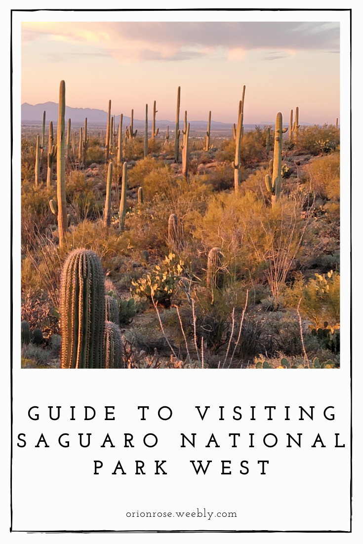
 Saguaro National Park is home to the largest cacti in the United States, the giant saguaro (pronounced sa - WAH - ro; no ‘g’ sound!). Named a national park in 1994, it is split into two halves, East and West, on either side of the city of Tucson, Arizona. Saguaro West has a younger, denser cacti forest, while Saguaro East has older saguaros and higher elevations. The Western half of the park is half the size of its Eastern counterpart, but that doesn't mean there's not a ton to see here. With over 150 miles of designated trails, it can be a little overwhelming to decide which ones to take. This route was recommended to us by one of the park rangers, and I thought it was fantastic! 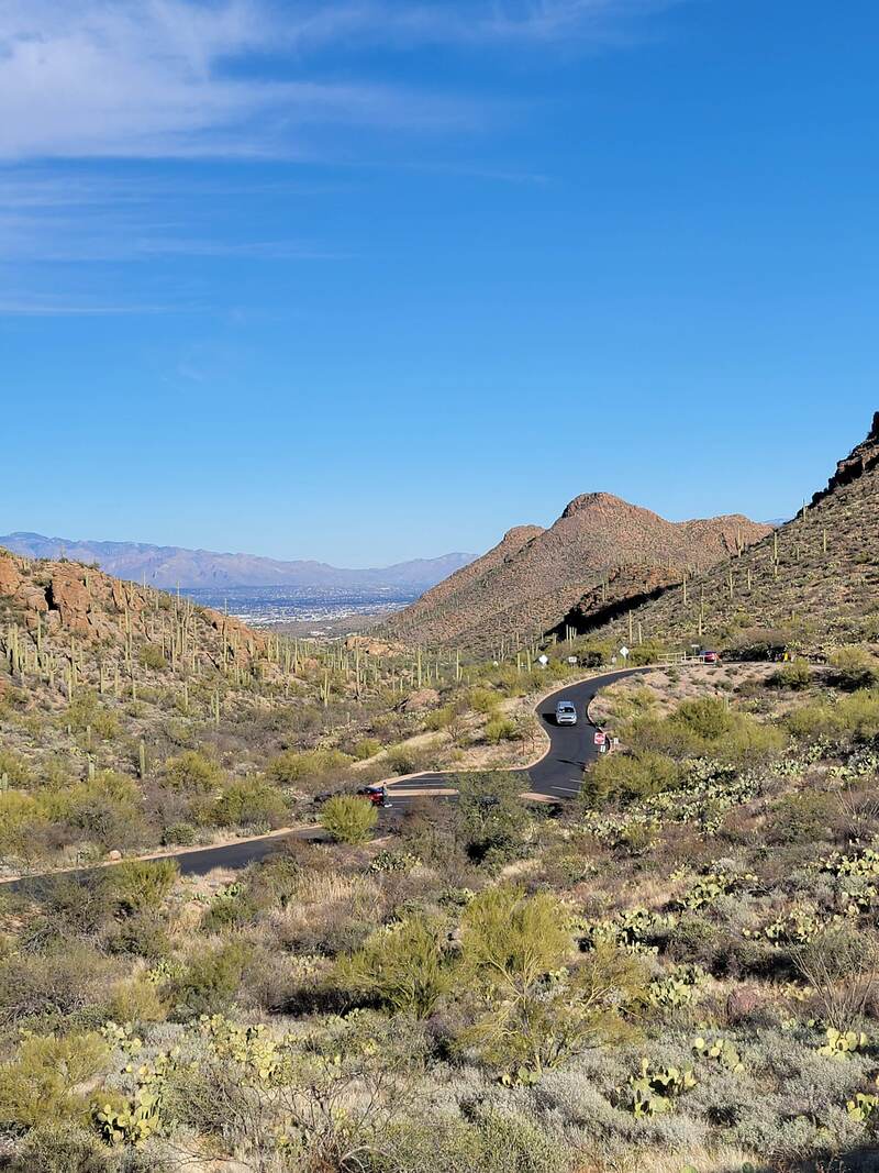 Visiting the Park: Basic FactsAlthough the park is split between the thriving metropolitan area of Tucson, it’s still remote. There’s no wifi and cell reception is spotty. There’s one visitor center in each half of the park, which is the only place with water fountains/refillable water stations - so make sure you stop and fill up before heading out. The visitor centers are also the only places with sinks and flushing toilets; pit toilets are available at every picnic area except Mam-A-Gah in Saguaro West. Rangers at the visitor center will be able to recommend hikes, let you know if changing weather conditions have made any trails or roads unsafe or impassable, and give you information about guided hikes and programs which may be taking place that day. Camping Campsites are available at Saguaro National Park East, but are backcountry only, meaning you’ll have to hike several miles to access them and they do not have running water. You can get a permit for backcountry camping online. Car or RV camping is prohibited, and there’s no camping at the West half of the park. That being said, there’s several established campgrounds outside of the parks. Gilbert Ray Campground at Tucson Mountain Park is less than 5 miles from Saguaro West, and is first come, first served. Fees Entrance fees for the park vary: $25 per vehicle, $20 per motorcycle, or $15 per bicycle or person entering on foot. Of course, if you have a National Parks Annual Pass like I do, it will get you in for free (the initial payment is $80, but since we love to visit the parks, it tends to pay for itself within a week :) ). Military servicepersons & veterans, children enrolled in the 4th grade in the U.S., and permanently disabled U.S. permanent residents can obtain annual park passes for free. Seniors (over 62) can get an annual pass for $20, or a lifetime pass for $80. There are also several free days throughout the year, which are listed here. 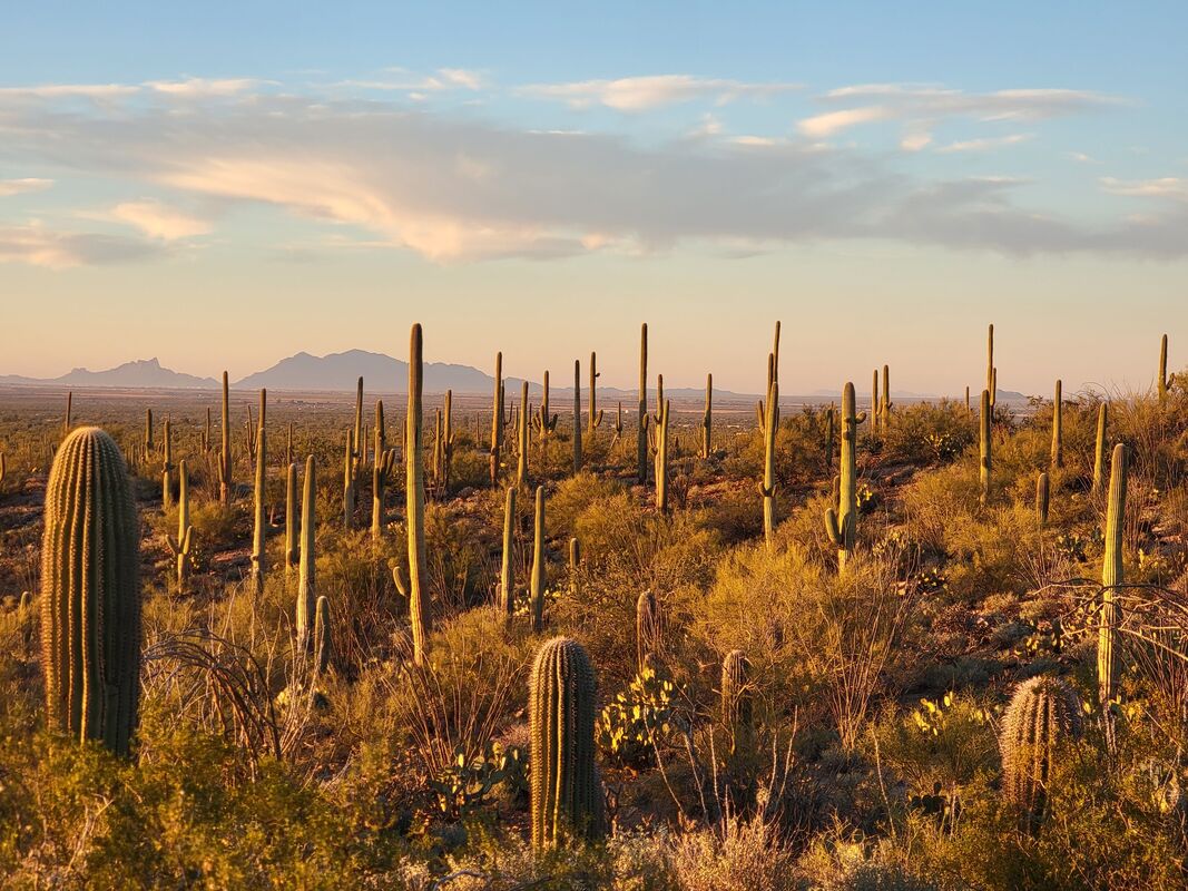 Ecology Saguaro National Park is known for - what else - its giant saguaros! Their scientific name is, fittingly, Carnegiea gigantea. I knew they were big, but I didn’t appreciate just how massive they grew until I had the chance to see some face-to-face; they can grow from 15 to 30 feet tall on average, but the tallest ever recorded grew to 78 feet! They’re everywhere around here, including dotted all over the city of Tucson, but actually thrive only in a relatively small region, hemmed in by winter temperatures and elevation. They start out tiny, only growing one to 1.5 inches in the first eight years of life. They don’t develop their iconic branches until 50 to 75 years old - and outside of the park, in regions with less rain, it may take up to 100 years. Saguaros start flowering at around 35 years, and bloom from late April through June. Saguaros reach adulthood at about 125 years, and may live over 200 years. They’re actually mostly water, and can weigh more than 6 thousand pounds!
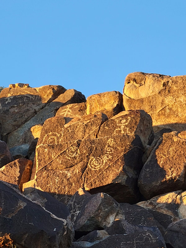
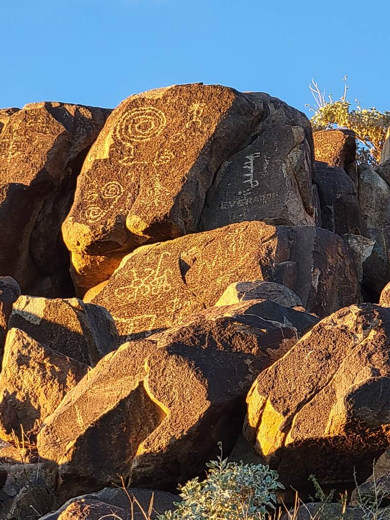
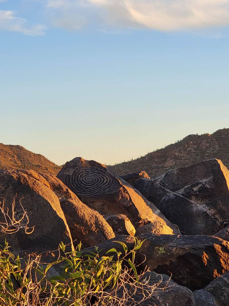
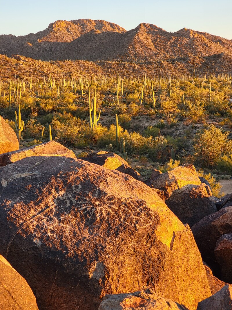
Hohokam petroglyphs at Signal Hill Indigenous People Saguaro National Park was historically home to the Hohokam people (which can be translated as “All Used Up”), who are thought to have lived here from 200 to 1450 a.d. They built ingenious irrigation systems and left beautiful pottery and petroglyphs behind, like the ones you can see at Signal Hill. Today, their descendants the Tohono O’odham (“Desert People”) continue many of their traditions, including saguaro fruit harvesting. O’odham bands are today separated by the US-Mexico border and split into four federally-recognized tribes - the Tohono O’odham Nation, the Gila River Indian Community, the Ak-Chin Indian Community and the Salt River (Pima Maricopa) Indian community - as well as the Hia-C’ed O’odham, who are not federally recognized. More information on the people of the Sonoran Desert can be found on the Tohono O’odham Nation’s website and this National Park handout. 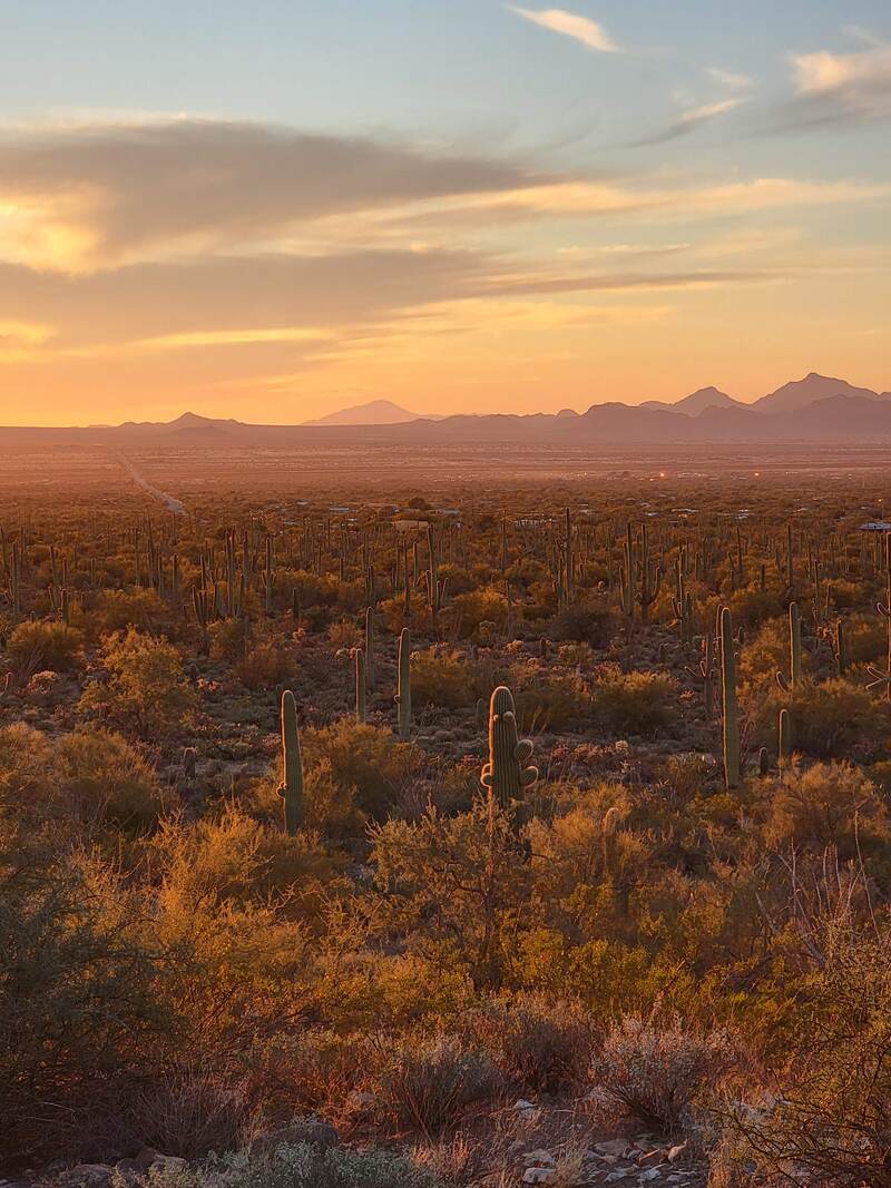 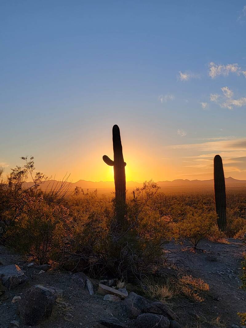 Accessibility As someone who often needs a cane to walk, I tend to seek out shorter or less strenuous hikes. I was able to hike both trails listed below easily, but neither are wheelchair accessible. There are several scenic drives between the parks. We took the Bajada Loop Drive, which is a 5 mile loop in Saguaro West, with pullouts for roadside sight-seeing and accessible parking at its two picnic areas (three if you take the detour down Golden Gate Road to Ez-Kim-In-Zin). It’s unpaved, but in great condition, making it easy to traverse. A fourth accessible picnic area is located outside of the loop to the north at Cam-Boh. Saguaro East’s Cactus Forest Loop is a paved 8 mile drive, and has seven accessible parking areas in addition to a number of pullouts. Saguaro East has two accessible picnic areas, Javelina (pronounced HAV - uh - lena) and Mica View. There are a few accessible trails in the parks, as well. Saguaro West’s Desert Discovery Nature Trail is located about halfway between the Bajada Loop and the Red Hills Visitor Center, and is a ½ mile paved trail with interpretive signs. In Saguaro East, the Desert Ecology Trail is a paved ¼ mile trail, also with interpretive signs. Both trails have resting benches. The Mica View trail, at the Mica View Picnic Area, is graded and wheelchair accessible for the first 0.7 miles. You can find more information on the park’s accessibility page. 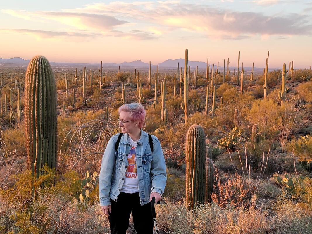 Saguaro National Park West in Half a DayItinerary:
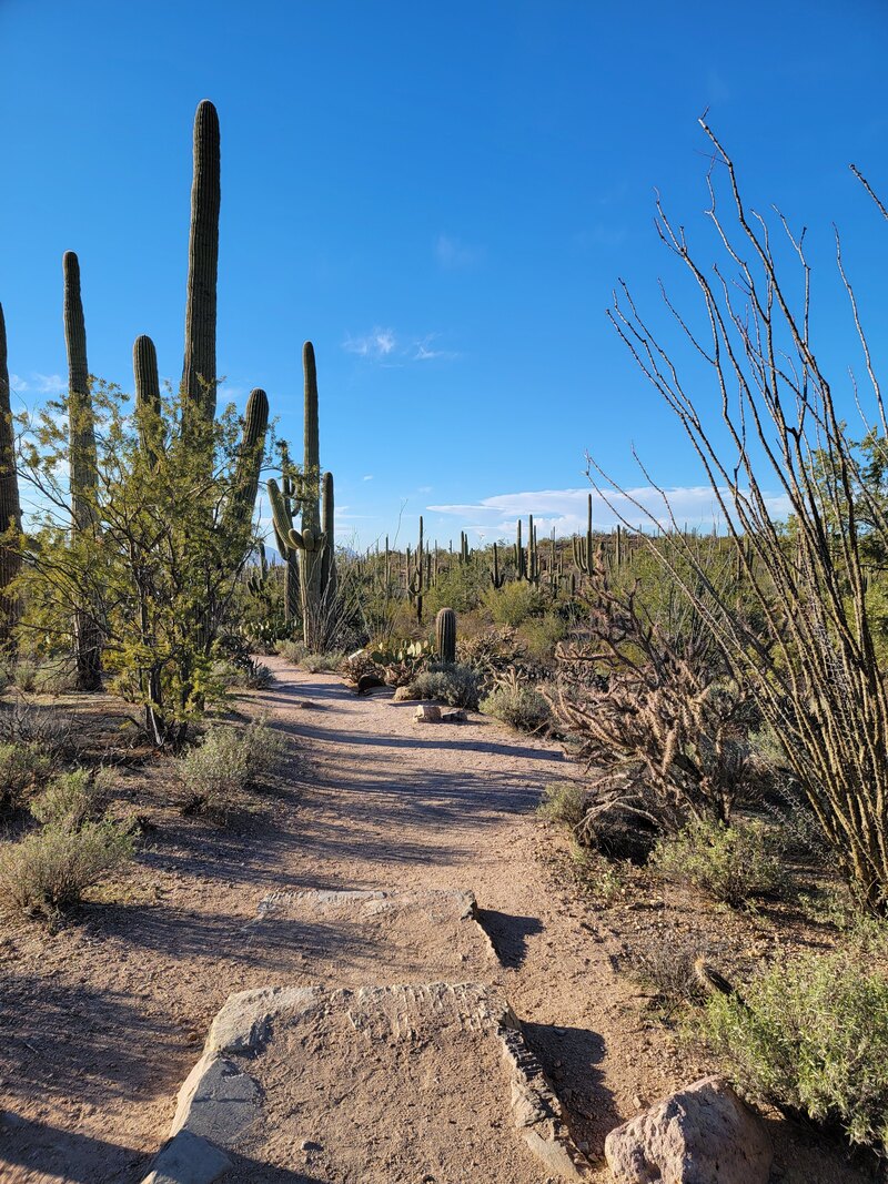
Less than 20 minutes from downtown Tucson, Saguaro National Park West was an easy choice to check off a bucket list item. We only had half a day to spend there, but a friend we were visiting recommended taking the Bajada Loop Drive, so we thought we would go check it out. We drove to Tucson to the Red Hills Visitor Center, where we picked up a map and talked with a ranger for a little bit to get some suggestions for what to see. He seconded our friend’s recommendation, and suggested two short hikes along the way: Valley View Trail and Signal Hill. Past the visitor center and Desert Discovery Nature Trail is Hohokam Road to the right, and the start of the Bajada Loop. Hohokam Road is one-way only, but later connects with the two-way Golden Gate Road. Both are unpaved but very well-maintained, meaning you don’t need 4WD to pass. Valley View is a little ways past “Sus” picnic area and Hugh Norris trail, less than 3.5 miles from the visitor center.
Valley View Overlook Trail is an out-and-back hike which comes out to only 0.8 miles, and offers a beautiful overlook of a valley full of saguaros. You’ll head down into a wash before taking some short stairs back up, and following a gentle incline to the top of a ridge. The trail is lined with interpretive signs highlighting some of the native plants, including my favorites, the chollas. The end of the trail has a small bench overlooking the Avra valley floor below and the saguaro forest. On a clear day you can see nearby mountains, including Picacho Peak.
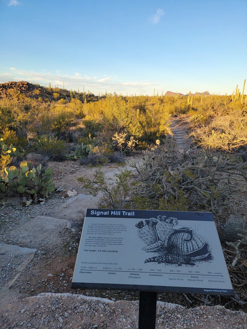
From here, we took a leisurely walk back to the car, and continued down Bajada Loop. Halfway along, Hohokam Road meets up with Golden Gate Road; there, you can turn right to travel to Ez-Kim-In-Zin picnic area, which is the starting point for several longer trails, or do what we did and continue left along the loop. This will take you over to Signal Hill picnic area, at the end of a 0.5 mile long offshoot road.
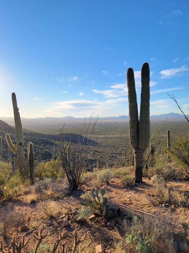
Signal Hill features a very short, 0.3 mile out-and-back trail with only a 26 foot elevation gain. However, it’s worth it for the stunning views of the valley below and the numerous petroglyphs inscribed on the rocks by the Hohokam people. From the north end of the parking lot, the unpaved trail weaves through the cactus forest and around a picnic area before dipping down into another wash. Stone steps lead you to the first petroglyphs, which are high up on the hill’s jumbled rocks. These steps lead you higher to the top of the hill, where dozens more petroglyphs can be seen just beyond a low railing.
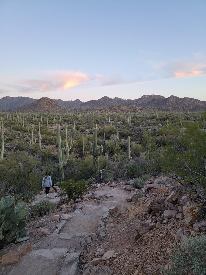
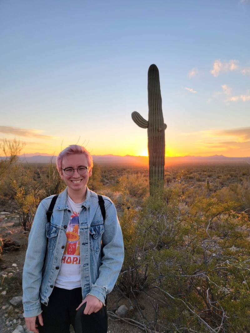
Several signs offer information on the Hohokam people and history of the area, as well as warnings to please not disturb these fragile works of art. To your right, the hill drops away for a sweeping view of the valley and mountains in the distance. We reached the top of the hill just as the sun was beginning to set, so we lingered here for a while. This was such a beautiful, peaceful place to be. 
If you have more time (and light), you can easily use either of these trails as a starting point for a longer hike. Wild Dog Trail can be combined with Valley View Trail for a 1.8 to 2.3 mile hike to Signal Hill, bypassing the eastern half of Bajada Loop. Signal Hill is also a starting point for several other, longer hikes, including the Cactus Wren, Encinas, and Manville Trails Loop. More hiking recommendations and a hiking checklist can be found on the park’s webpage. Have you visited Saguaro National Park? What did you think? Were there any spots I missed that you think I should visit on another trip? Sound off in the comments below!
Like this post? Why not share it?If you enjoyed this article, please leave me a comment telling me what you think! Or, if you found it useful, share it with your friends! You'll be helping me turn my passion for travel into a business, and more importantly, you'll be helping your friends out with any travel questions they might have, too. Check out my books & art for sale:
If you liked this post, you may also like:
0 Comments
Your comment will be posted after it is approved.
Leave a Reply. |
Hi, there! Call me Kris. I’m a world traveler, author and artist working to showcase the world's beauty and inspire you to find your confidence to see the world!
searchLooking for somewhere in particular? Search here:
shopsocial mediapopular posts
The Best Ever California Coastal Road Trip
What It’s Really Like Living Out of A Van For A Week

The Ultimate Travel Bucket List: 1000+ Ideas From Around the Globe
|

 RSS Feed
