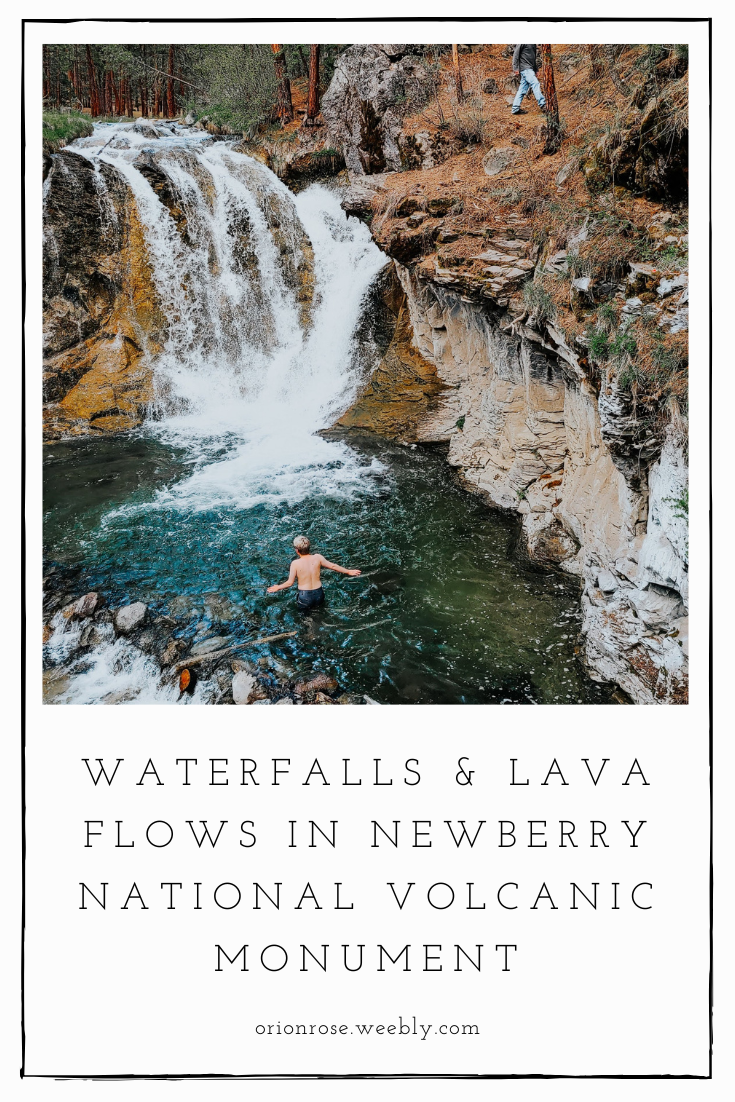
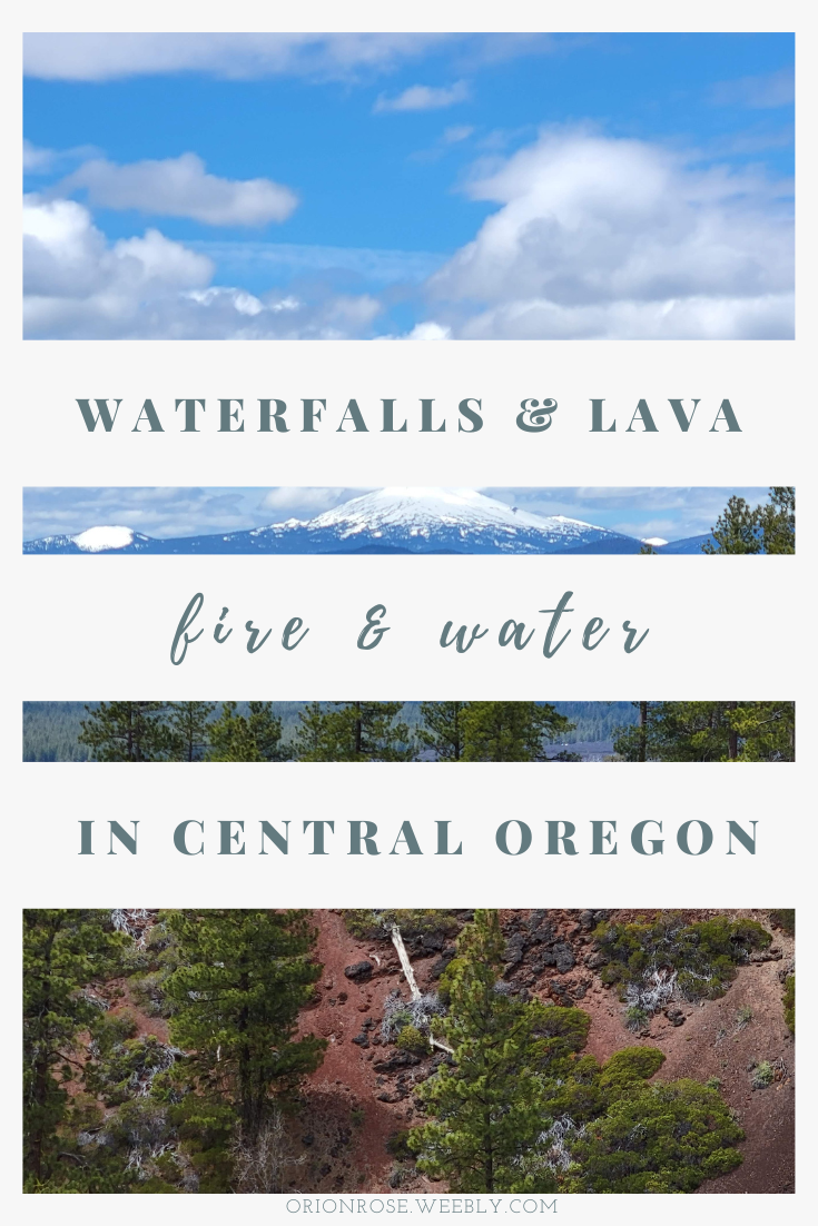
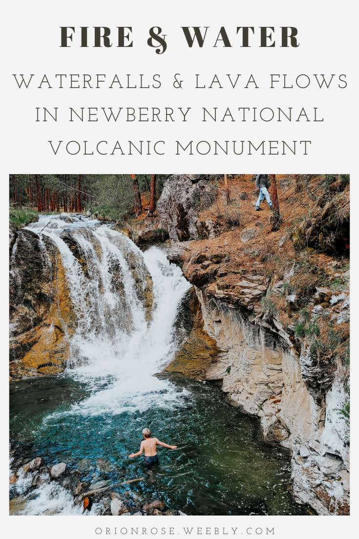
Endless fields of hardened lava, mountains of jagged black glass, and thundering waterfalls - Oregon has been called the Iceland of the United States, and it’s not hard to see why.
For those of us without the time (or the funds) to jet away to Europe on a moment’s notice, Oregon is a surprisingly great substitute, with a match for nearly all of Iceland’s most popular attractions. One of the best places to find them? Newberry National Volcanic Monument, which boasts ancient lava flows, lakes nestled into the top of a massive caldera, and the longest cave in Oregon! If you’re looking for world-class views on a budget, check out some of the things to see and do in Newberry: Quick Facts
Newberry National Volcanic Monument is inside Deschutes National Forest, just south of Bend in Central Oregon. The Monument is over 54,000 acres, with plenty of lakes, waterfalls, and lava features, including a lava tube cave.
Newberry Caldera - formed when part of the larger Newberry volcano collapsed in on itself - is 17 miles wide, but makes up only a tiny portion of the volcano. At 1,200 miles wide, the Newberry volcano is the largest volcano in the Cascades and approximately as big as Rhode Island. It’s the source of numerous hot springs, cinder cones and obsidian flows in the area. While you aren’t likely to see any flowing lava, it is still considered active! Its oldest flows are approximately 400,000 years old, but its most recent eruption was 1,300 years ago (practically yesterday by geologic standards)! Know Where You Walk
Indigenous people have lived in what is today called Newberry since time immemorial; archaeological records even show Indigenous presence in the caldera 10,000 years ago. Newberry largely falls on Klamath and Yahooskin-Paiute land, part of the larger Klamath Tribes.
A statement on the Klamath Tribes’ website reads: "We are the Klamath Tribes- the Klamath, the Modoc and the Yahooskin-Paiute people, known as mukluks and numu (the people). We have lived in the Klamath Basin of Oregon, from time beyond memory. Our legends and oral history tell about when the world and the animals were created, when the animals and Gmok’am’c – the Creator – sat together and discussed the creation of man. If stability defines success, our presence here has been, and always will be, essential to the well-being of our homeland and those who abide here." Visiting
It costs a mere $5 per vehicle per day to visit Newberry when the visitor center is open, or you can get in with a pass, including a Northwest Forest, local, or interagency pass. We used our interagency/National Parks annual pass.
The Lava Lands Visitor Center is open from May through October, from 9 to 5, and is open 7 days a week starting in June as of 2022. You can double check on their website to make sure of the times. It’s approximately 12 miles south of Bend on Highway 97, or about halfway between Bend and the town of Three Rivers to the south. They had great exhibits on the area’s geologic and cultural history, plus a small bookstore, which I always like to visit to find information on the area (and stickers. Always stickers). The visitor center has restrooms with flushing toilets, and potable water to allow for refills. Accessibility
The Forest Service has been putting out a series of videos about accessible things to do in the Pacific Northwest. They have a nice one about the Lava Lands Visitor Center and nearby hikes.
Newberry has several accessible hikes near the visitor center, including the Sun-Lava paved path, which is 5.5 miles long and fully paved. The Trail of the Whispering Pines is 0.25 miles, or 0.4 miles when hiked in a loop from the visitor center. It’s fully paved, and features botanical interpretive signs and resting benches. The end of the trail takes you to the visitor center parking lot, or it can be combined with the Trail of the Molten Land for a 1.6 mile hike. The Trail of the Molten Land is 1.1 miles (1.25 from the visitor center), a third of which is fully accessible. The other portions of the trail are paved, but “steep and bumpy,” so aren’t recommended for those in wheelchairs. The trail also provides interpretive signs about the geology of the area. A map of the area and types of trails can be found here. 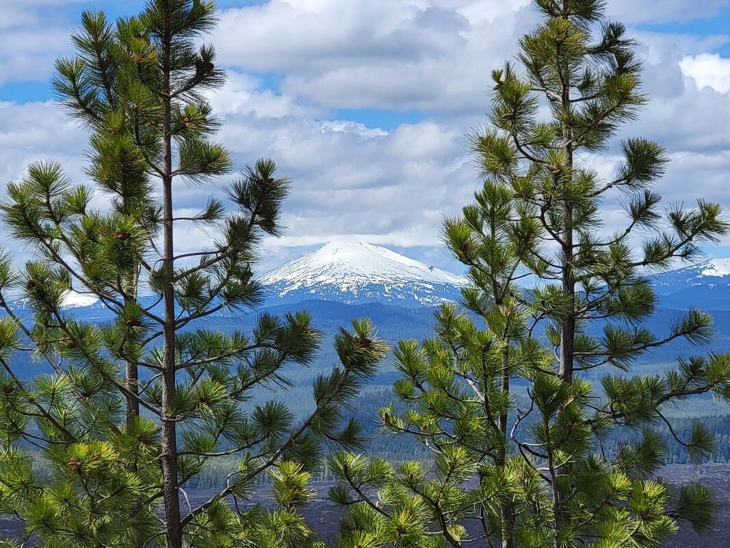
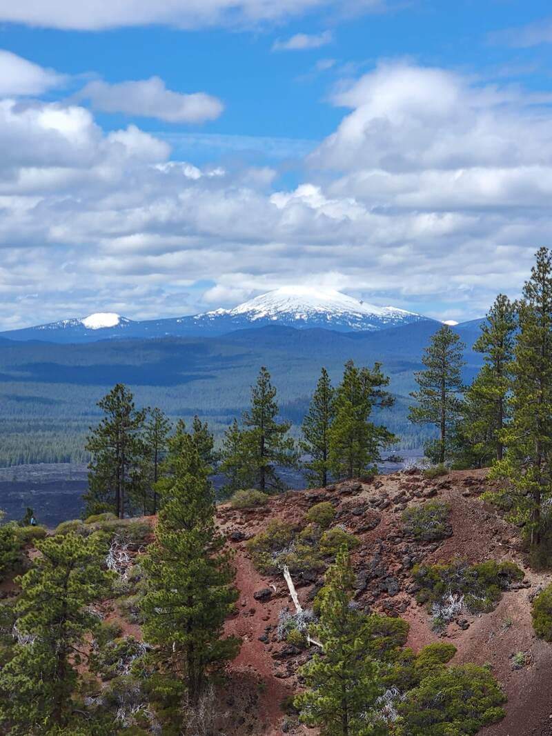
View from Lava Butte
Touring Waterfalls & Lava Flows in Newberry
I spent two days camping and hiking in Newberry, split between the northern and southern regions of the park.
Day One: Lava FeaturesLava Butte
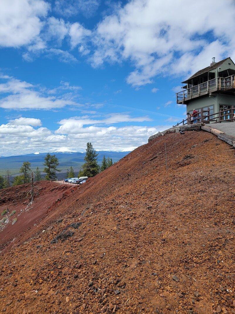
Lava Butte was our first stop in our Newberry Tour, since the ranger at the welcome station recommended it first thing! Lava Butte is a cinder cone near the visitor center, looming 500 feet tall and providing outstanding views.
Because we visited before peak season starting June 17, we were able to reserve a free 30 minute parking permit at the registration booth to drive up to Lava Butte. During peak season, there’s a $3/person shuttle that runs every 20 minutes between Lava Butte and the visitor center, though you’re always welcome to walk or bike up to the top between sunrise and sunset.
There is a paved trail to an active fire lookout, but it’s largely too steep for wheelchair users to navigate. The parking area offers beautiful views of the surrounding area, including the nearby lava flows and cinder cones, all the way to towering peaks of the Cascades. No water is available, but there is a pit toilet and a few picnic benches.
We took the short Lava Butte Trail, which leads you around the rim of the cinder cone. The trail is made of loose cinders, and is a little steep, so it’s not recommended for people in wheelchairs or those who are afraid of heights :) I was able to do it just fine with my cane, though the loose rocks did cause me a little trouble on some of the steeper portions. 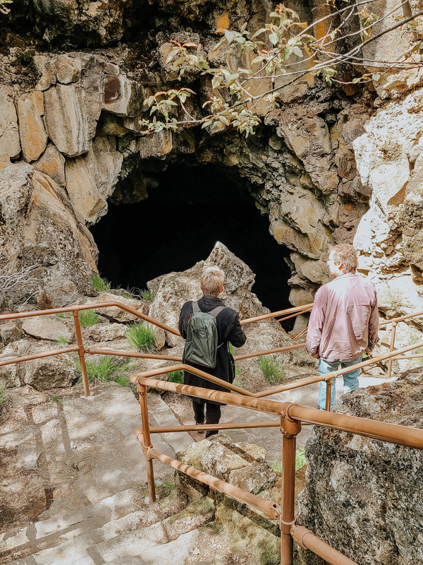
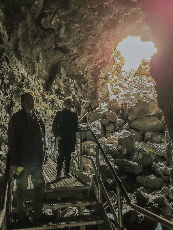
At the entrance to Lava River Cave
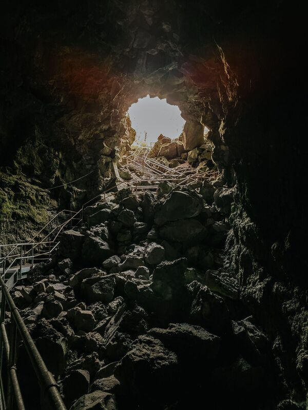
Lava River Cave
I love caves - to the point where I considered also adding a stop at California’s Lava Beds National Monument if I had the time - so I was excited to see there was a cave to visit in Newberry!
Lava River Cave is a mile long, the longest in the state. It allows self-guided tours so you can walk it at your own pace.
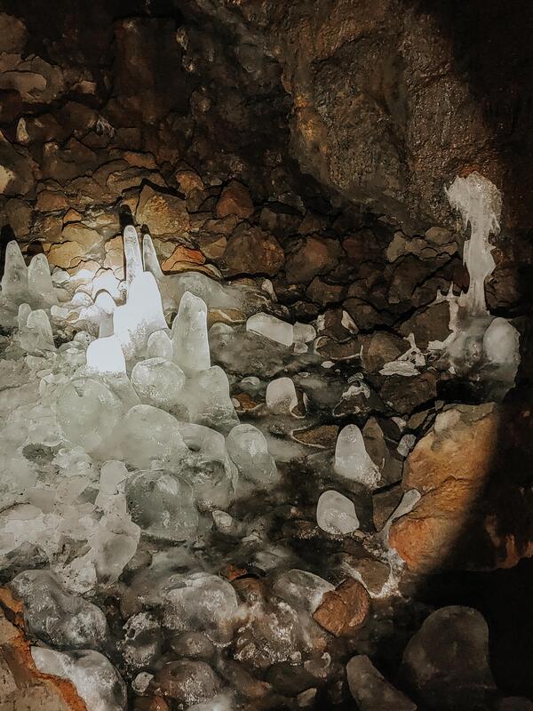
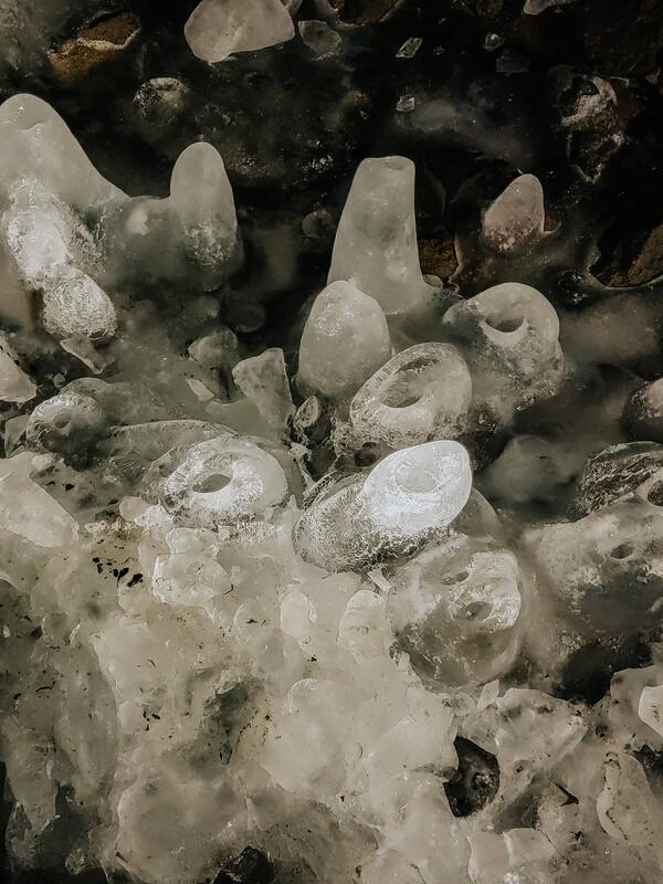
You descend into a deep hole in the ground, as the light slowly fades around you. We visited in late May, but there were still ice “stalagmites” reaching up from the ground towards the entrance (bring a coat!).
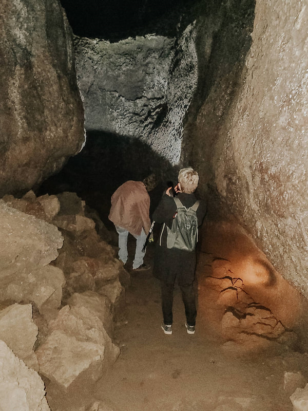
At one point, you pass directly under Highway 97, about 80 feet above your head. From here, you head into the “Tube in Tube” section, where lava shelves bridge overhead, forming two tubes, or a “cave within a cave.”
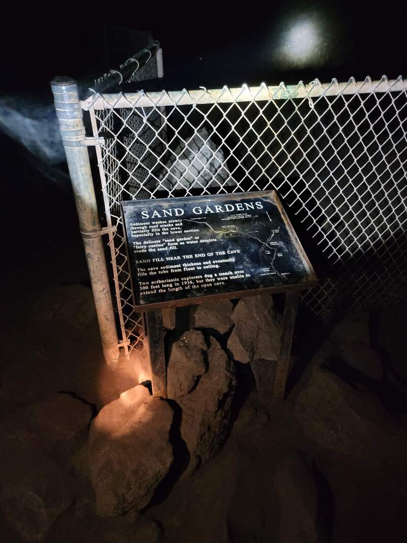
Past the fenced-off Sand Gardens - like sand castles made by cave creatures - the sand in the cave increases. A few hundred feet from the stop sign, which protects people from unstable ceilings and bats from being disturbed, the sand fills the chamber to the top. It isn’t clear how far back the tunnel continues past this point.
The Logistics: Lava River Cave is open from early May to approximately September 15, as of 2022. The park is requiring reservations on Reservation.gov beginning August 1, 2022, in addition to the recreation pass to get into the park.
They ask that you complete a mandatory 10 minute safety talk before entering, and will request that you leave behind any clothing or gear which you’ve taken to any other cave in an attempt to control the devastating spread of White-nose syndrome. I also recommend that you rent a $5 light source from them; it was way more powerful than our Maglite (which needed new batteries), and you really need a lot of light to fully appreciate the cave. More information on opening times can be found on their website. Accessibility: The portion of the trail open to the public is about 2.2 miles long. I was able to walk it with my cane, but there are 55 steps to get down to the main portion of the cave, at which point the ground is largely very uneven, with some flat boardwalks and additional stairs. There were also portions when I (5'4" tall) had to duck a little to fit through. 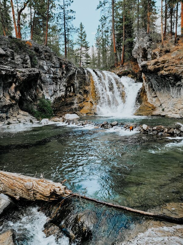
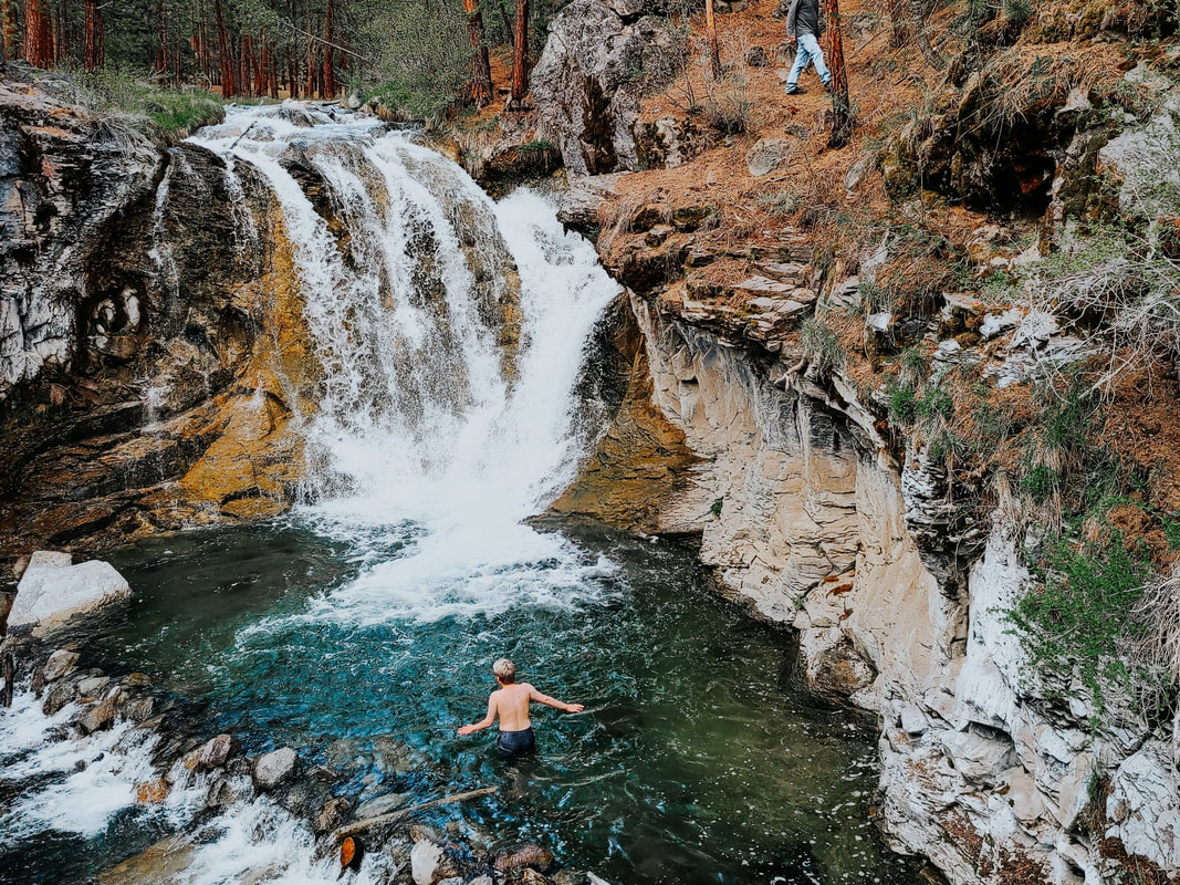
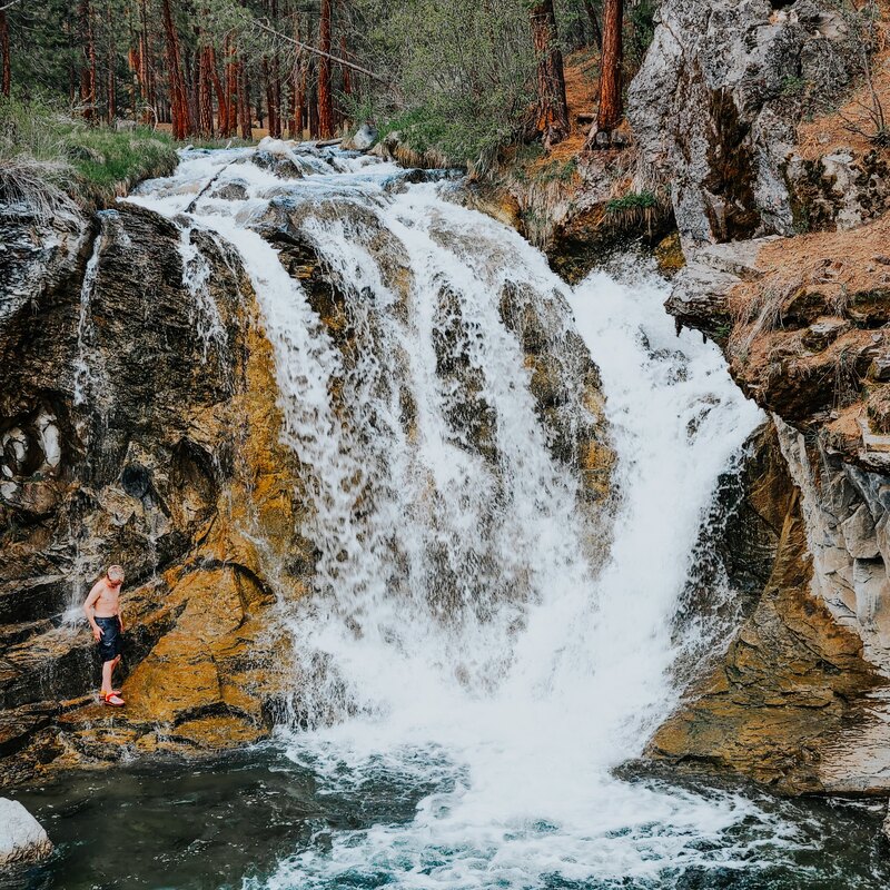
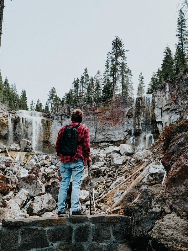
McKay Crossing Falls & Campground
Staying at McKay Crossing was one of life’s happy accidents. I rarely plan ahead where I’m going to stay while camping/van living, so our decision to stay here was solely based on seeing a campground name next to a river on the map.
We were able to snag a spot right next to the calm and lovely stream, which would have been wonderful on its own, but my map had also shown that there was supposed to be a waterfall nearby. I was expecting something small, but only a hundred meters down from our campsite, the ground fell away and I was left with this incredible view. 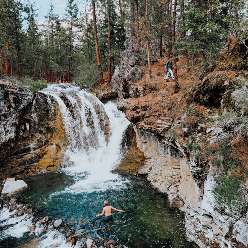
McKay Crossing Falls is 26 feet tall, with a beautiful, calm pool at its base walled off by fallen logs and rocks. I found it invigorating, but the water is pure snowmelt, so it was incredibly cold! Perfect for a very hot summer’s day, but maybe not an early summer evening in May :)
The Logistics: The campground is $12 a night, and is open from late May to the first of October. It’s also rustic! It has a pit toilet (only one on the side of the river we were on - I’m not sure if there was another on the other side), and no running water, so be sure to pack your own. We took an unpaved/dirt road to access it, and if I recall correctly none of the roads in the campsite are paved either, meaning it would be difficult to access in wetter weather.
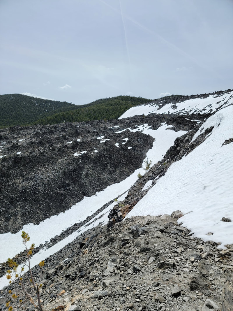
Snow-capped Big Obsidian Flow
Day Two: Newberry CalderaBig Obsidian Flow
On our second day in Newberry, we drove east of our campground to the main attractions in Newberry Caldera. One of these was Big Obsidian Flow, the youngest lava flow in Oregon at a “mere” 1,300 years old.
Keep runnin up that hill...
Here, you can hike up a mountain of slick black obsidian, a natural glass, and jagged pumice. You can learn more about the geology on their website! Although it’s beautiful, the park asks that you please not take any of the rocks.
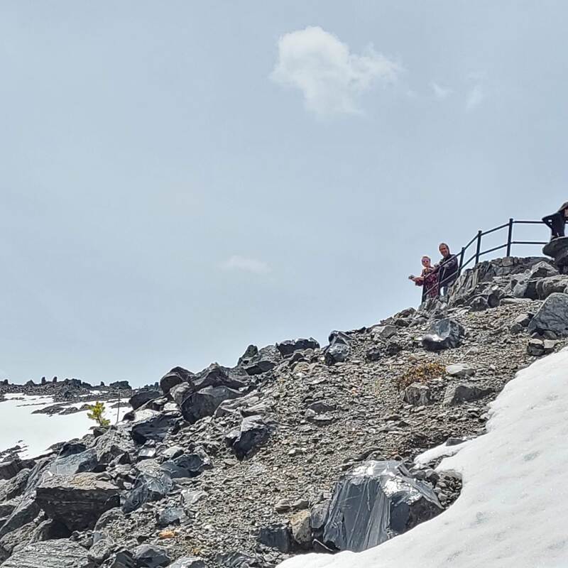
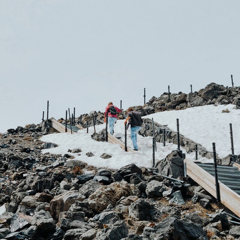
The farthest we made it was actually just the tip of the trail!
The loop trail is less than a mile long and has interpretive signs, but it was largely snowed over when we visited. It was slippery with ice and many of the railings hadn’t been put in place yet, so I’m sure the rangers wouldn’t have recommended we climb it. We caught a view of the very low Lost Lake, but were wary of climbing any higher to the main part of the trail due to the snow.
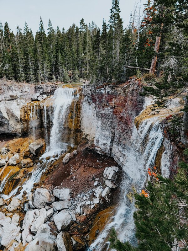
Paulina Falls
Our next stop was Paulina Falls, an 80 foot tall spectacle known for its double falls. There’s a paved, accessible trail to an upper viewpoint, and an unpaved dirt trail down to a lower viewpoint. The upper trail is a well-maintained, easy walk at approximately a third of a mile, and shows you a side view of the falls.
The view of Paulina Falls from the Upper Viewpoint
The lower trail is approximately half a mile, with four switchbacks to the bottom of the canyon. It offers views of the falls from the rocky bottom. There was less snow on this trail than at Big Obsidian Flow, but since we visited before peak season, there were one or two areas where you had to duck under a fallen tree.
If you have time and the weather is in your favor, I recommend hiking in or along Paulina Creek towards Pipeline Falls. We heard there are several natural waterslides in the area! 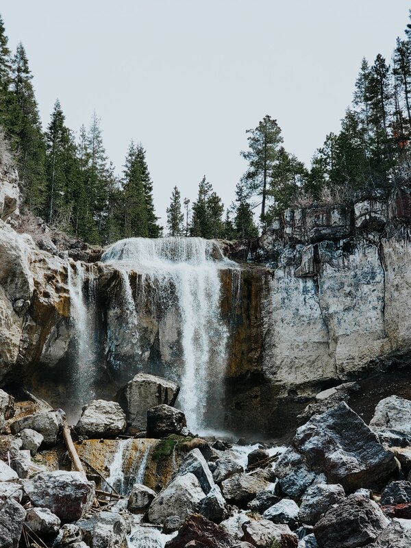
The view of 1/2 of Paulina Falls from the lower viewpoint
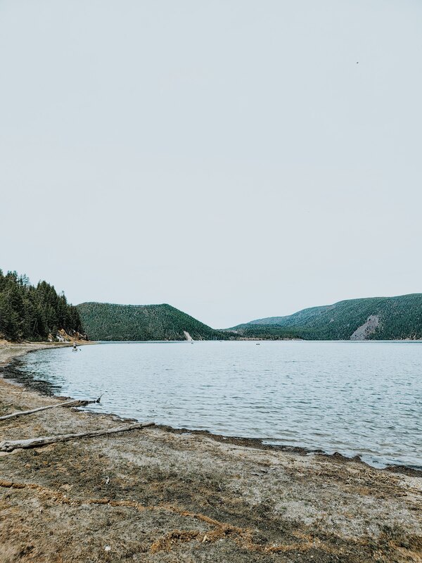
East Lake
East Lake is a great destination for those of us who love being on or in the water, as it allows both motorized and non-motorized boats, and has opportunities to rent nearby. It’s also a great place for trout fishing.
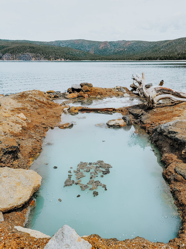
We hiked along the shoreline to reach the East Lake Hot Springs, one of many thermal areas sprung up from the magma (relatively) close to the Earth’s surface in Newberry Crater. You can also easily reach the area by boat, which is the more highly recommended method.
The USDA Forest Service suggests looking for tan rock outcroppings and small bubbles in the water which smell like rotten eggs due to sulfur. They’re completely underwater during higher lake levels, but during dryer seasons you’ll often find locals have dug into the sand to create a small pool. The water was lukewarm when we visited, though there may have been warmer areas farther down or if we had dug deeper. There was also some scum floating on the surface of the thermal pool, which made it less than an ideal place to hop into, but it was still a nice walk along the edge of the lake. 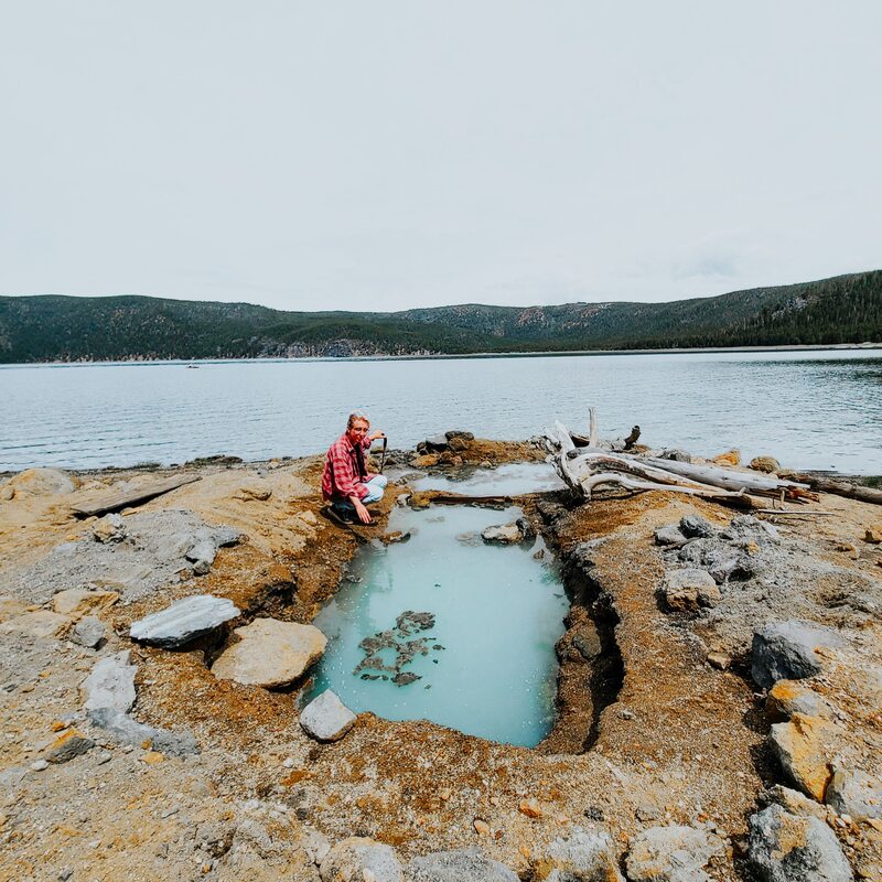
Testing the waters! It was lukewarm at the surface :)
Other Nearby Recommendations
There are plenty of other attractions in the area which we didn’t get to. The area around Bend is full of amazing parks and monuments, each of which offer incredible opportunities for hiking and enjoying the scenery.
Where are you planning to visit in Newberry and in the greater area around Bend? Is there anywhere you would like to recommend? Let me know in the comments below! See more adventures!
Like this post? Why not share it?
If you enjoyed this article, please leave me a comment telling me what you think! Or, if you found it useful, share it with your friends! You'll be helping me turn my passion for travel into a business, and more importantly, you'll be helping your friends out with any travel questions they might have, too.
If you liked this post, you might also like:
0 Comments
Your comment will be posted after it is approved.
Leave a Reply. |
Hi, there! Call me Kris. I’m a world traveler, author and artist working to showcase the world's beauty and inspire you to find your confidence to see the world!
searchLooking for somewhere in particular? Search here:
shopsocial mediapopular posts
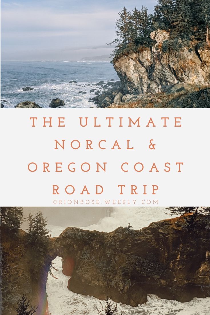
The Best Ever California Coastal Road Trip
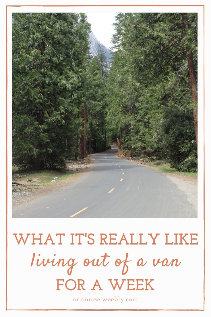
What It’s Really Like Living Out of A Van For A Week

The Ultimate Travel Bucket List: 1000+ Ideas From Around the Globe
|
 RSS Feed
