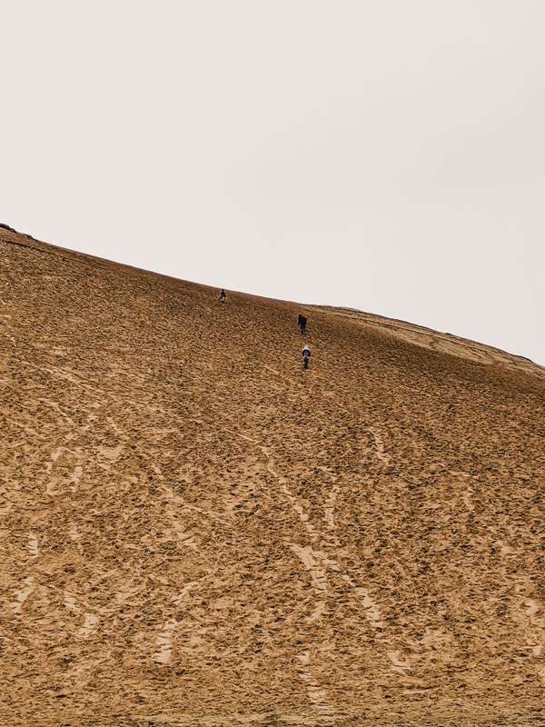
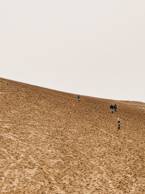
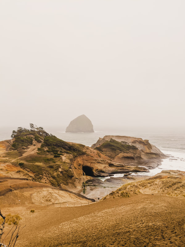
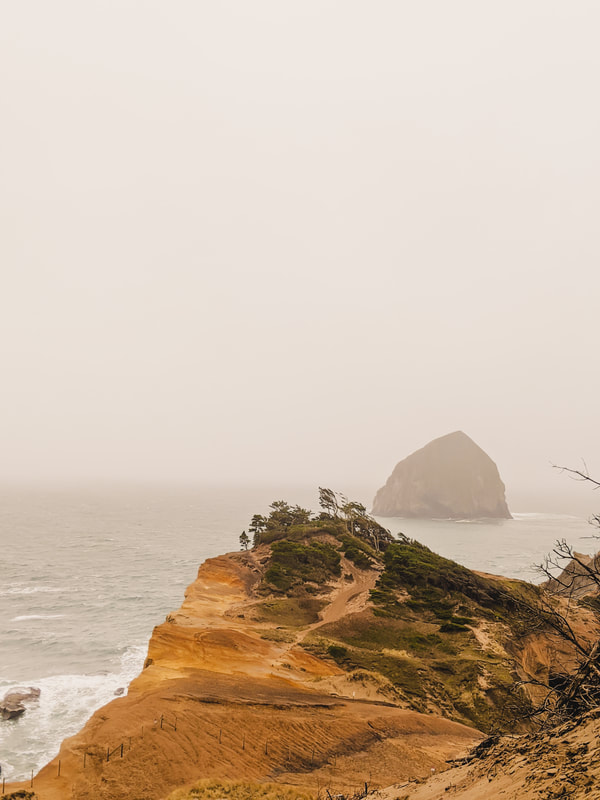
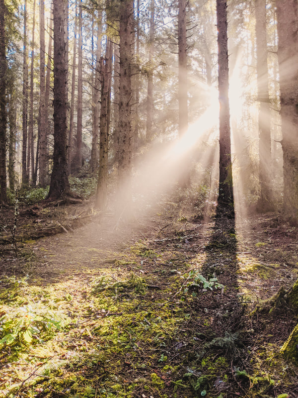
 As I’ve mentioned about a thousand times before on this blog, I used to live in the Pacific Northwest, and am firmly convinced that it’s one of the most beautiful places in the world. If you had any doubts about that, I’m pretty sure I’m about to change your mind. Northern California and Oregon are famous for their towering trees, rugged coasts, and moody weather. The Lost Coast unfurls into acres of fog and crashing waves, eroding sea arches into rocks and creating the perfect environment for Redwoods -- the only place in the world these massive, magnificent trees grow. Any time of year is a good time to go, depending on what you’re looking for: Summer brings crowds and higher prices, as well as moody, lingering fog, while Winter brings fewer crowds, some stunning storms, and the chance for spotting light rays (a photographer’s dream). The Pacific Northwest doesn’t get much in the way of the traditional four seasons, but there is a bit of a difference in Spring and Fall: Fall brings the best and clearest weather, with less fog, limited storms, and fewer people, but there’s very little in the way of fall colors. Spring, on the other hand, brings wildflowers and occasional showers (less often than Winter, but more than Summer, although it still rains in Summer, too). I’ve experienced this part of the world at every season, and I really don’t think there’s a bad time to travel here. It all depends on the type of weather you’re looking for, how much you want to be rained on, and how many people you’re willing to contend with! When traveling here for vacation, one week is usually the sweet spot to hit up the major sites. While I can’t really speak for the hotels in the area, as I tend to camp or live the van life, Booking.com is my go-to choice for finding hotels when I travel. In addition, campsites in the National and State Park systems are always a good bet if you’re going more rustic. Now that you know a little bit more about what to expect, let’s dive into the best stops along your Northern California and Oregon Coast road trip! Haystack Rock (No. 2) at Cape Kiwanda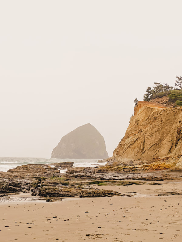 There’s actually two Haystack Rocks in Oregon, but we start our journey at the southern one in Cape Kiwanda. Located a half mile offshore, this rock is also known as Chief Kiawanda Rock. The beach doesn’t look like much from the road, with a sandy parking lot hemmed in by a brewpub on one side and a hotel on the other, but straight ahead you’ll catch your first view of the rock. From there, hike right along the beach to the dunes, which mark the southernmost point of Cape Kiwanda State Natural Area.
Cape Kiwanda is actually part of the Three Capes Scenic Route, along with Cape Meares and Cape Lookout. It’s the smallest of the three, but one of the best for hang gliding, kite flying, and of course, admiring the waves.
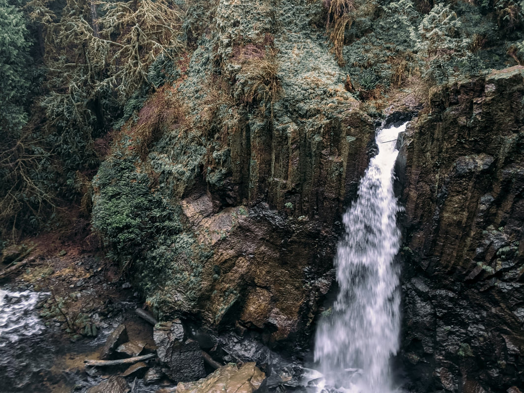
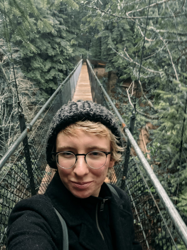
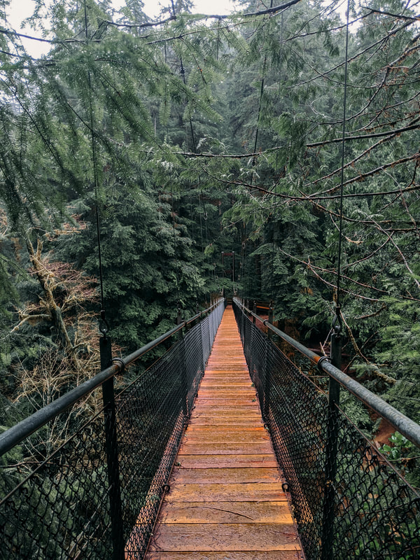
I hiked to the top of the dune (which was much taller than it looked, and it already looked really bloody tall) for a beautiful view of the rock and surrounding area. From here, you can go right to explore more of the park and its beautiful coves, or run down back to the beach (just try not to twist your ankle like I did running in the soft sand). 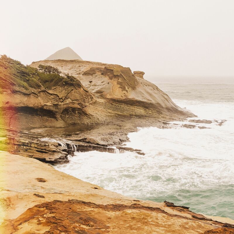 Neskowin Beach State ParkNeskowin Beach is an interesting stop along your route, but it’s important to go at low tide! Neskowin Beach is home to the Neskowin Ghost Forest, the remnants of an ancient forest that’s now little more than stumps sticking up from the sand where these trees used to grow. When the tide is low, you can see around 100 of these stumps in the sand and shallow surf. According to Travel Oregon, they are “covered in barnacles, mussels, and other sea life. The center of some of the particularly large stumps have been eroded away, creating shallow pools in which sea life gets trapped when the tide is out. You can sometimes see small fish or crabs in these little pools, waiting for the tide to come back in and release them back into the ocean.” Getting to the Ghost Forest is a little tricky; the beach is hemmed in by private properties, so your best bet is to park in the public parking lot/turnoff and walk to the beach access in front of Proposal Rock, a small island at the edge of the beach. When the tide is at its lowest, you can reach the island to climb a short trail (lacking a guard rail) to a small forest on its crown, as well as a beautiful view of the Ghost Forest at its westernmost point. 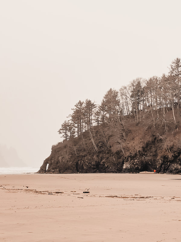 Proposal Rock To reach the Ghost Forest itself, you’ll need to pass over Slab Creek, a shallow but cold creek that cuts the beach in half, flowing into the ocean just South of Proposal Rock. Unfortunately, I wasn’t aware of all this at the time, so while the tide wasn’t too high, and I could see some of the stumps from my vantage point on the wrong side of the river (cue dramatic shouting from The Mummy), I didn’t know how deep the creek was, and wasn’t feeling brave enough to cross it in the dead of winter, as I was worried it would soak my only coat. I then spent a lot of useless time trying to find a different way to the Forest, since I could see a couple walking around on that side, no no avail. Moral of the story: go at low tide, bring a change of clothes, and don’t be afraid to get wet! Drift Creek Falls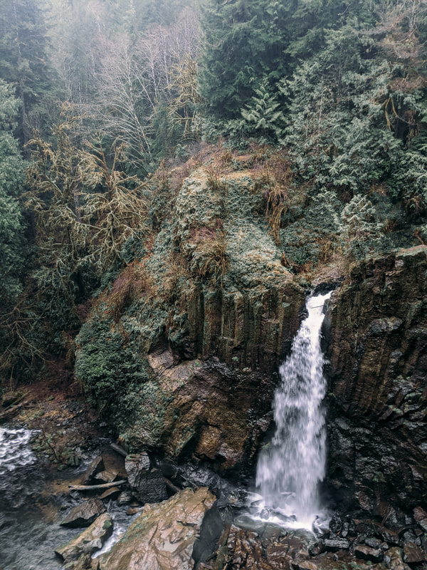 I’ve written before about Drift Creek Falls, but it’s worth writing about again to add it to this list. Situated in Siuslaw National Forest, a massive park stretching 630,000 acres and home to several spots in this list, Drift Creek Falls is one of the most popular hikes in the park, for obvious reasons. It’s a three mile round trip, out and back hike which takes you down into the forest, over a suspension bridge, and to the foot of a 75 foot tall waterfall cascading into a basalt gorge. Yes, you have to hike uphill on the return journey, but it’s not strenuous.
I took this trip in late December, and I naively thought I would have the hike mostly to myself. Nope! It was pouring down rain (I took my umbrella along), I spent half of the hike dodging mud puddles and trying not to lose my shoes, and I still ran into a good twenty or thirty other hikers. I’ll be honest: I sort of have a pet peeve about running into other hikers when I’m out and about -- it ruins the illusion in my head that I’m all alone in pristine wilderness, outside of society and connecting with nature on this carefully maintained forest trail -- but really, how can you feel anything but love for your fellow humans when you’re in a place as pretty as this? 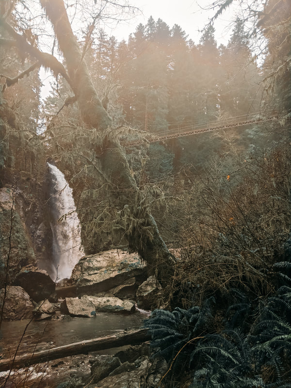 Devils Punchbowl State Natural AreaDevil’s Punchbowl State Natural Area is a cool roadside stop on your way South. Geologists believe that the punchbowl was most likely created by a roof collapsing over two sea caves, which was then eroded by the sea. Parking is limited, so I ended up parking at the foot of the hill and hiking to the top, near the picnic area. At low tide, you can enter the punchbowl itself, but high tide is where it gets its name, as water churns and roars, making it look just like, well, a giant punch bowl! After drinking in your fill of the views (pun intended), head south along Otter Loop and climb the steps down to the beach, a popular location for surfers. To the north of the punchbowl, you’ll find plenty of opportunities for tidepooling, too.
Cape PerpetuaCape Perpetua Scenic Area is another Siuslaw National Forest gem, and features the highest viewpoint accessible by car on the Oregon coast. 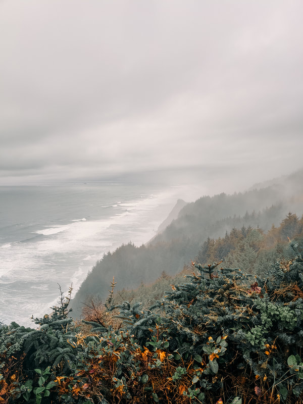 Since I was traveling south, I hit up Devil’s Churn first (there seems to be a running theme with names in this part of the world). It’s a narrow inlet just north of the Cape Perpetua Visitor Center, created by a fissure in the rock that has been eroded over the course of thousands of years to an 80 foot wide chasm. Here, you have two options: you can admire the chasm from the overlook at the north end of the parking area, or take the Restless Waters Trail down the side of the cliff to experience Devil's Churn up close. Only the first part of the trail is wheelchair accessible, taking you to the first overlook, while the rest of the trail leads to stairs which lead you down to the volcanic rock surrounding the churn. When you’ve finished exploring the churn, head south to the Cape Perpetua Visitor Center to learn about the surrounding park, 2700 acres in total. Next, hike the Captain Cook Trail, featuring the Spouting Horn and Thor’s Well.
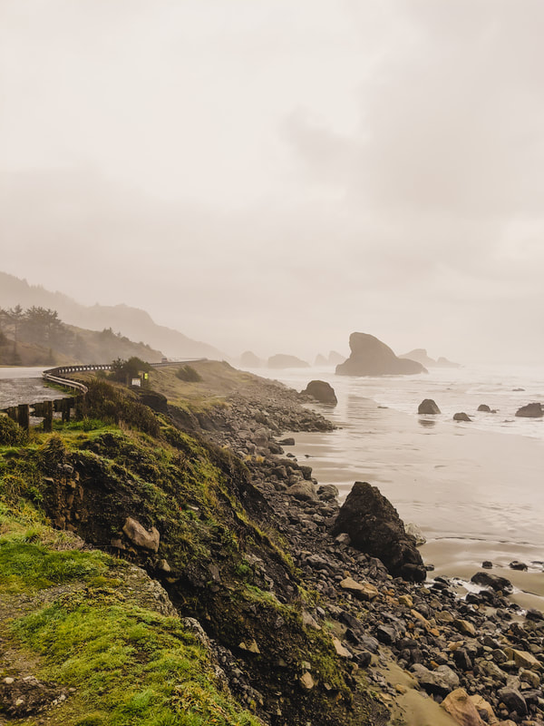
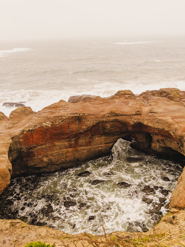
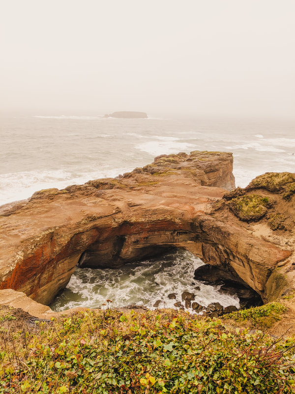
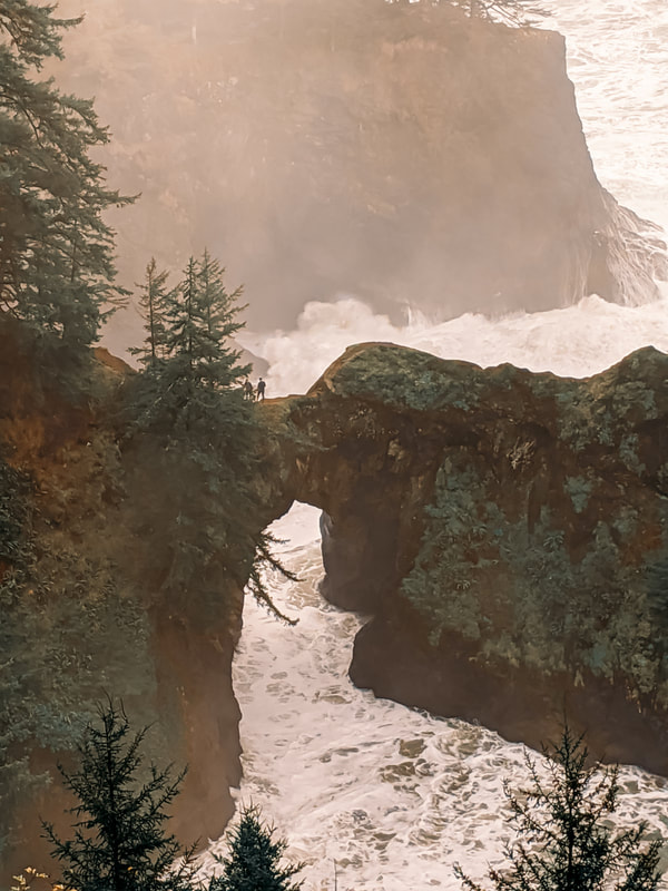
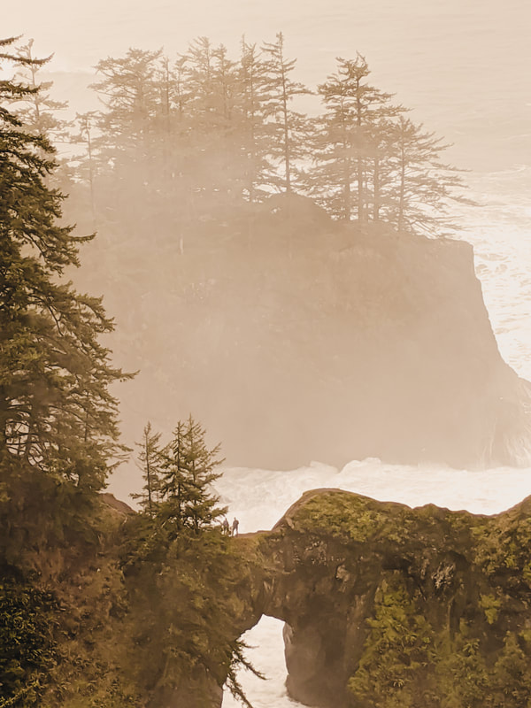
This is a relatively short hike, but it leads to two of my favorite spots in this park. Heading south, you’ll pass by Thor’s Well first, but since it was high tide, I didn’t actually notice it in my first pass! I headed straight for Spouting Horn, where incoming waves created a small sea cave, and wore a small hole in the top. The waves crash in, air and water pressure build up, and it creates a spout and horn noise! (Hence the name). 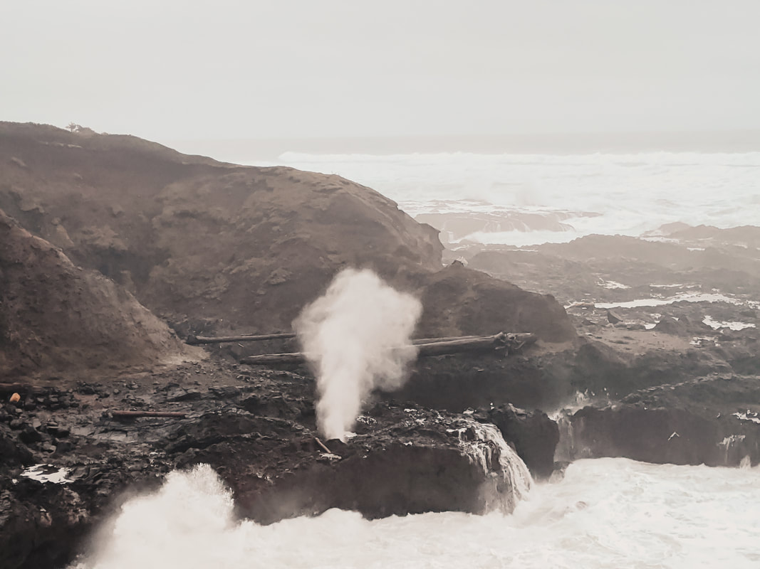 Spouting Horn I backtracked to Thor’s Well, a famous, seemingly bottomless sinkhole also known as the drainpipe of the Pacific. This post by Local Adventurer offers an excellent photography guide, suggesting that you arrive about an hour before high tide to orient yourself for the best shots. At this time, you can walk down onto the rocks to get a closer view, but you’ll still get wet. I visited at high tide during both a storm and right before a King Tide date, which meant the water was much higher than usual, so I didn’t feel comfortable getting close, but the viewpoints offered a good opportunity to admire the Well, even if it wasn’t a great vantage point for photography. One thing to note: Thor’s Well is infamous for being a particularly dangerous part of the landscape, but this is a little exaggerated -- it’s no more or less dangerous than any other spot on this coastline. It’s important to be wary of sneaker waves at any level of tide, and never turn your back to the ocean. Arch Rock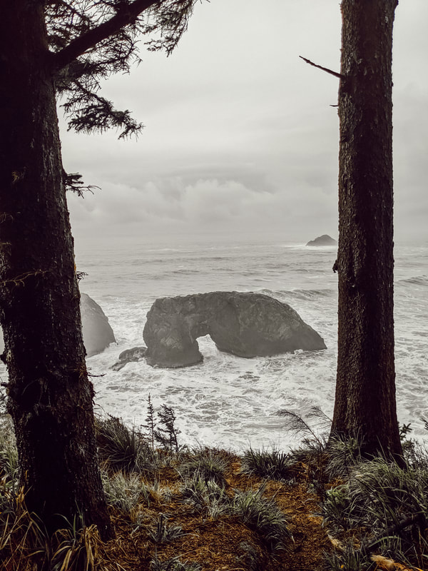 Arch Rock is another delightful roadside stop along Samuel H Boardman State Scenic Corridor, which also features Secret Beach and Natural Bridges Viewpoint -- so close you could easily spend half a day hiking between them! A parking lot leads to a small, tree-lined path leading down to the viewpoint, showcasing lots of offshore sea stacks and islands. At the right vantage point, you’ll be able to peer through Arch Rock itself. This is a great spot to see at sunset, and a beautiful place for a picnic -- I made dinner here and ate overlooking the sun set over the ocean, which I can't recommend enough for a relaxing end to your day.  Natural Bridges ViewpointNatural Bridges Viewpoint is one of Oregon’s most famous coastal views, and certainly one of its most beautiful. 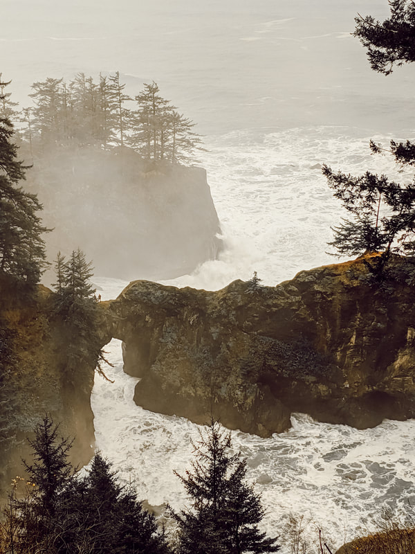 From the vantage point to the left of the parking lot, you can see an incredible view of the bridges. I recommend going here during golden hour, that hour just after sunrise or just before sunset, where the glow of the light makes everything soft, and the ocean is at its most beautiful. You can hike down to the bridges themselves along a trail to the right of the parking lot, but in all honesty, I found the directions online to be conflicting, the trail confusing, and honestly too steep and muddy with winter rains to be safe when I went. Despite wandering the trails for a solid hour trying to find the right path down, this was still one of my favorite spots (certainly one of the most memorable) for its sheer beauty. I definitely want to come back and try finding the right trail again… but maybe during summer, when things are drier.
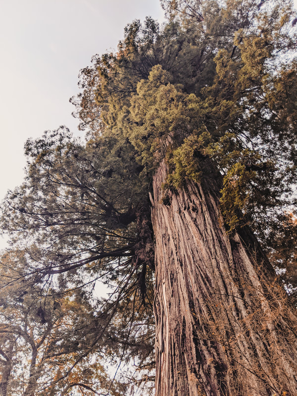
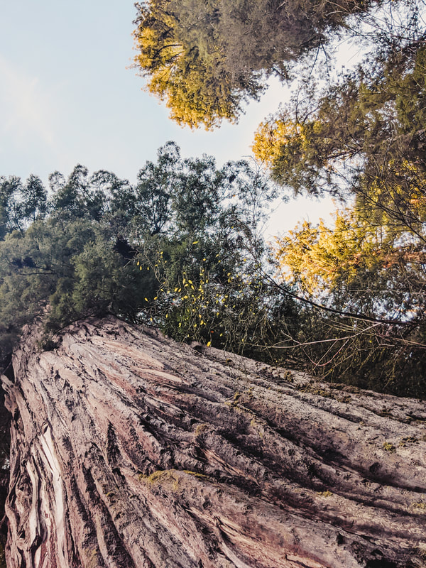
Redwood National & State ParksAfter Natural Bridges, we say goodbye to Oregon and head down to Redwood National and State Parks to experience one of the most beautiful forests in the world.
As I’ve mentioned before, the Redwood National and State Park system is a collection of several different parks cooperating together, including Redwood National Park, Prairie Creek State Park, Jedediah Smith State Park, and Del Norte State Park. They’re spread out along the coast, with the lowland or coastal areas featuring the biggest trees, and the highland or mountain areas featuring smaller trees and valley views. There are a few hikes that I make sure to take every time I’m in the area: the roadside stop Big Tree is a great place to start to see one of the larger trees in the parks (though still not the largest), and Founders Grove is a good introductory trail. 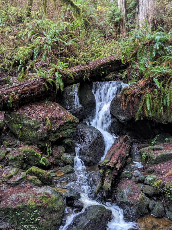 Trillium Falls A few of my other recommended trails include:
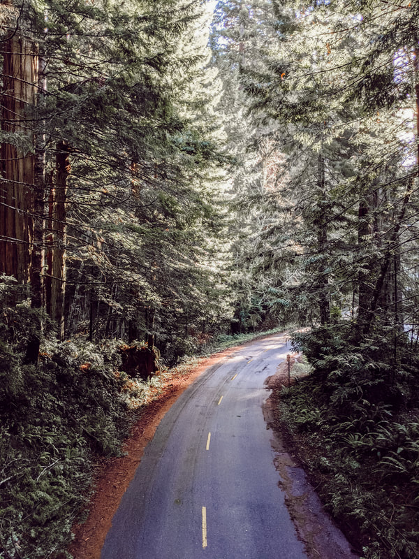 Overlooking the road to Lady Bird Johnson Grove Trail When your feet get tired, I recommend taking some time to just drive through the woods. Coastal Drive is part of old Highway 101, and offers beautiful views of the rugged Lost Coast. Just outside the park is the famous Avenue of the Giants, one of the best Redwood drives, with multiple small hikes along the side of the trail. Sue-meg State ParkFinally, just south of the Redwoods is Sue-meg, a small but stunning state park situated right on the coastline. It’s only about one square mile large, but is full of crisscrossing trails that can keep you occupied for a good day. Previously known as Patrick's Point State Park, its official name was restored to Sue-meg State Park in 2021 to honor the name the Yurok people have called this place since time immemorial. Rosie Clayburn, the Yurok Tribal Heritage Preservation Officer, said about the change: “The Yurok people have always referred to this place as Sue-meg and now it will forever be called its correct name. We continue to practice our cultural traditions at Sue-meg just as our ancestors did for millennia.” 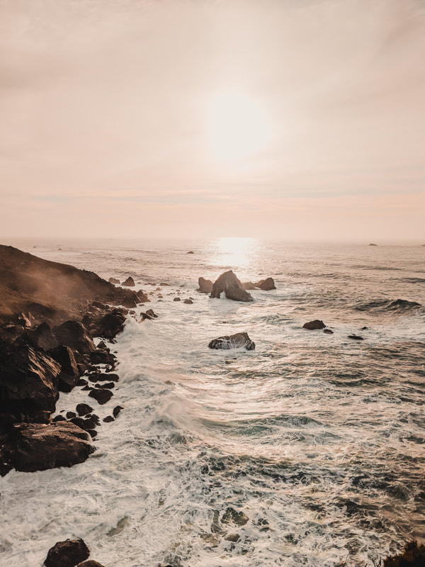 Sunset view from Wedding Rock Despite being less than a quarter of a mile long, Wedding Rock Trail offers the best ocean views in the park, and is the ideal place to watch the sunset, long after the morning fog has burnt off. It can also be combined with the Rim Trail, a 3.1 mile coastal trail which stretches along the length of the park and leads down to Agate Beach, a popular site for rock collectors. 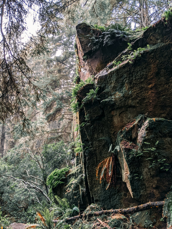 Ceremonial Rock For a different sort of view, hike Ceremonial Rock Trail, which is less than a mile out and back, and takes you to a massive rock in the center of the forest, overlooking a field. Here, you can climb up Steps Trail to the top of the rock for a bird’s eye view of the forest canopy.
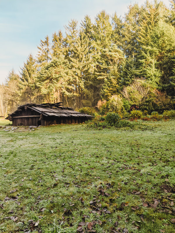
Finally, I highly recommend the recreated Yurok village, Sumeg, which was built using traditional materials and modern tools in the traditional style of a permanent village. Like most other hikes in the park, it’s quite short, at only a quarter of a mile, but makes up for its length with plenty of points of interest. You can walk here from the visitor’s center (where you can pick up a pamphlet explaining how each building was made and used), where you’ll pass by a canoe and a native plant garden. The village itself features traditional style family homes, a sweat house, changing houses, another redwood canoe, and a dance house. It was built by Yurok people and is used by local Yuroks for youth education and to share their culture with the public. If you have time, check out these places, too!I ran out of time to visit these places, but they’re on my list for next time!
 Northern California and Oregon’s coastline isn’t for the faint of heart, but for anyone willing to brave the finicky weather and spotty cell service, you’ll find a land studded with stormy seas, endless waterfalls, and some of the most beautiful forests on earth. Have you ever been to the Pacific Northwest? Were there any spots I left out that you feel should have been included? See more adventures!
Like this post? Why not share it?If you enjoyed this article, please leave me a comment telling me what you think! Or, if you found it useful, share it with your friends! You'll be helping me turn my passion for travel into a business, and more importantly, you'll be helping your friends out with any travel questions they might have, too. If you liked this post, you may also like:
0 Comments
Your comment will be posted after it is approved.
Leave a Reply. |
Hi, there! Call me Kris. I’m a world traveler, author and artist working to showcase the world's beauty and inspire you to find your confidence to see the world!
searchLooking for somewhere in particular? Search here:
shopsocial mediapopular posts
The Best Ever California Coastal Road Trip
What It’s Really Like Living Out of A Van For A Week

The Ultimate Travel Bucket List: 1000+ Ideas From Around the Globe
|

 RSS Feed
